Rentals
 Locations
M: 8am - 5pm
T: 8am - 5pm
W: 8am - 5pm
T: 8am - 5pm
F: 8am - 5pm
S: 8am - 12pm
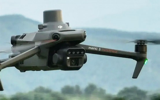
Map and monitor the health of your crop with the DJI Mavic 3M Aerial Surveying Drone. It sees and records information on your crop and the ground it occupies in minute detail and real time – right down to the centimetre and microsecond. It precisely detects and maps areas where growth is stunted by problems like crop lodging, failure to germinate, and weed pressure. The process takes little time, covering 200 hectares in a single flight.
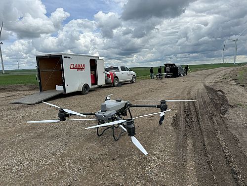
Book a demo to see it in action.
Contact Us Quote Request Similar InventoryExtra Information
Equipped with multiple state-of-the art cameras, the Mavic 3m employs 4G technology, its own Smart Farm platform, and cloud storage for pin-point-accurate prescription mapping of problem spots. That mapping guides targeted aerial spraying and spreading of chemicals and fertilizers, saving you time, money, and over treatment of healthy crops. The result is strong, even yield potential.
Features
The 3M uses two kinds of cameras. A single 4/3 CMOS 20-megapixel RGB camera with RTK provides detailed time and position data. Four 5MP multispectral cameras and a light sensor identify terrain features, including the height of crops, trees, and hills. Working with the 3M’s omnidirectional obstacle sensing, they guide your aerial spraying and spreading to specific areas where they’re needed.
DJI O3 Transmission integrates transmitting and receiving of signals to assure flight control over ultra-long transmission distances of 15 km (about 9.32 miles). A downward-facing vision sensor follows the terrain and keeps the drone flying safely at a consistent height over physical land features like trees and steep slopes.
Prescription mapping is primarily used to identify problem spots in need of variable-rate spraying or spreading. But it can also provide surveying information about your land’s boundaries, size, and varying elevations.
Mavic 3M Benefits
- Compact and portable – folds up for easy storage.
- Zero footprint – no tractor, truck, or sprayer tires on your crop
- Helps you manage multiple crops, like wheat, corn, potatoes and more
- AI tools allow one person to manage yield monitoring and applications on large tracts of land.
- Helps with water drainage and brush management
- Livestock operators can manage water supply and heat stress. Drones can also help with herding.
Discover the DJI Mavic 3M at Flaman.
Interested in taking a step into the future of crop management? Book a demo to learn more about the Mavic 3M’s capabilities and to see all of its benefits in real-time.